Use cases / Refinery methane monitoring
Multi-year refinery methane monitoring from space. Turning satellite data into ESG-grade evidence.
A retrospective study of a major refinery in Riyadh, Saudi Arabia, using Sentinel-2 imagery at 20 m resolution. Three years of observations, more than 100 leak events detected, and a complete detect-verify-mitigate-verify loop.
100+
Leak events detected
2021–23
Monitoring period
20m
Spatial resolution
3–30k kg/h
Emissions range
Contents
Context
A major refinery in Riyadh, Saudi Arabia engaged in a methane emissions analysis to better understand and manage fugitive emissions across its operations. Due to privacy requirements, the refinery name and exact location remain undisclosed.
Using Sentinel-2 satellite imagery at 20-meter spatial resolution and our proprietary methane detection algorithm, MethaneMapper, we conducted a retrospective methane monitoring study spanning 2021 to 2023. The goal was to identify significant methane leaks, quantify emission rates, and provide actionable intelligence to support mitigation and ESG reporting efforts.
Challenge
Refineries are complex industrial environments with large footprints, multiple emission sources, and limited visibility into intermittent methane releases. Traditional on-ground inspections and sensor-based surveys are valuable, but they are resource-intensive and may miss leaks that occur across large areas or over long time periods.
The refinery owner needed a scalable way to:
- →Monitor methane emissions over time
- →Identify previously undetected leaks
- →Quantify emission magnitude
- →Prioritize on-site inspections and corrective action
- →Generate credible evidence for sustainability and ESG initiatives
The key challenge was turning satellite observations into operationally useful intelligence — guiding field teams toward the most critical problem areas, not just delivering pretty heatmaps.
Solution
We deployed MethaneMapper on Sentinel-2 imagery to analyze the refinery over a three-year monitoring window. The system processed historical satellite observations to detect methane plumes, estimate emission rates, and map approximate source locations across the site.
Our team produced detailed reports containing:
These reports were shared with the refinery owner, enabling their operations team to validate findings and plan follow-up action. Based on the satellite-derived intelligence, the owner conducted targeted field surveys using local sensor systems to pinpoint leak sources more precisely and implement mitigation measures.
Following mitigation, we re-ran the analysis to assess changes over time and provide updated evidence of emissions reduction — closing the loop from detection → verification → mitigation → verification.
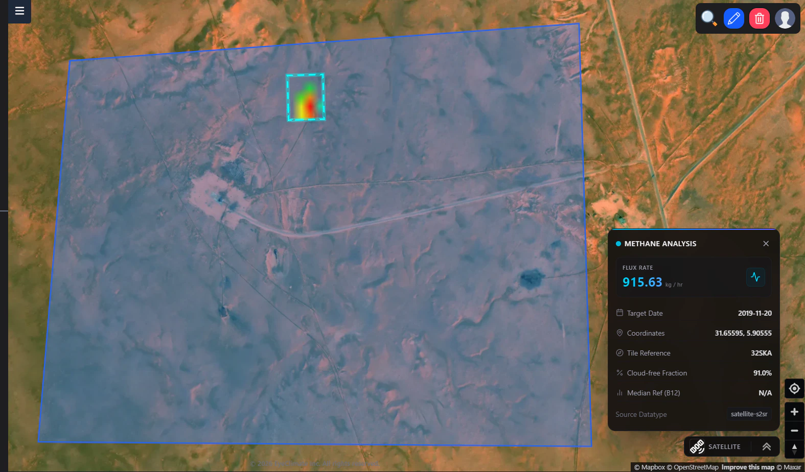
- 01Estimated methane emission quantities per source
- 02Source location insights across the refinery footprint
- 03Event timing and leak occurrence history
- 04Cumulative leak history across the full study period
Results
The analysis identified more than 100 methane leak events across the refinery during the study period. Estimated emissions ranged from approximately 3,000 kg/hour to 30,000 kg/hour — revealing a number of high-impact emission sources that may otherwise have remained difficult to track systematically.
01 / Detection
100+ events
Methane leak events identified across 2021–2023.
02 / Magnitude
3–30k kg/h
Quantified emissions at operationally significant levels.
03 / Action
Field-verified
On-site sensor surveys confirmed sources and informed mitigation.
04 / Compliance
ESG-ready
Follow-up analysis supporting reporting and progress evidence.
This case demonstrates how satellite-based methane monitoring can move industrial operators from detection to verification, mitigation, and measurable progress toward sustainability objectives — without disrupting day-to-day operations on the ground.